બુધવાર, 27 જૂન, 2012

Amarnath Yatra.........

Situated in a narrow gorge at the farther end of Lidder Valley, Amarnath cave stands at 3,888 m. and is 46 Km. From Pahalgam and 141 Km. from Srinagar. Though the original pilgrimages subscribes that the Amarnath yatra be undertaken from Srinagar, the more common practice is to begin journey at Chandanwari, and cover the distance to amarnath and back in five days. Pahalgam is 96 Km. Srinagar.
Amarnath is regarded as one of principal Hindu Dhams. The holy cave is the residence of the holy trinity, Shiva lord. The guard of the absolute, lord Shiva, the destroyer, is present in the form of ice Lingam in this cave located at a more remote end of the valley of Lidder. This lingam is made naturally of a stalagmite of ice which awakes and weakens with the moon.


The Yatra
The trek to Amarnath yatra begins at Srinagar on the panchami day of the bright half of the month. The next halt enroute is Pampur, 9 miles south east of Srinagar. Subsequent halts are at Avantipur, Brijbihara and Martand. Martand is known for its ancient temple dedicated to the Sun God - now in ruins. Enroute to Martand are Anantnag and Gautamnag. Martand is known as the architectural lion of Kashmir. It is a temple with a colonnade of 84 columns full of artistic work. This temple dates back to Lalitaditya of Kashmir of the 8th century. The next halt is at Aishmukam, and the next is Pahalgam, which is reached on the day of Dasami, the tenth day of the bright half of the month. At Pahalgam is the confluence of the rivers Seshnag and Liddar.
Next the enroute of stop is Chandanwadi, from where the confluence of the rivers Asthan Marg and Seshnag. Promote is to the top Pishu Ghati, thought to be the site where the demons were crushed by the gods. Promote is to the top the lake Seshnag with a size of approximately 12000 feet above sea level. The next halt is at Wavjan before to raise it stiff with the passage of Mahagunus to a size of 14000 feet, after which there is to the bottom a slope carrying out to Panchatarni. From here, the cave of Amarnath is reached the day of full moon, and the pélerinage is complete.


THE MYTH
The cave of Amarnath was where Shiva lord reported the secrecy of immortality, Amar Katha with his Wife Parvat. Shiva hesitated initially but finally gave inside.Shiva wanted to reveal the secrecy in a place of isolation far from any life being and thus chose the cave of Amarnath. In preparation, Shiva left his Nandi (the Bull), which he rode at Pahalgam. At Chandanwari, he released the moon from his hair and on the banks of Lake Sheshnag, he released the snakes. Son Ganesha was left at Mahagunas Parvat and at Panjtarni, Shiva left the Five Elements behind - earth, water, air, fire and sky - that make life possible. As a final precaution, Shiva created Rudra named Kalagni and ordered him to set afire and eliminate every living thing in and around the Holy Cave. Finally, Shiva and Parvati entered the Amarnath Cave where he began meditating on a deerskin. He then narrated the Amar Katha to Parvati. Unknown to them, a pair of mating doves eavesdropped on this conversation and learned the secret. Reborn again and again, they have made the cave their eternal abode. Today, pilgrims claim seeing the pair of doves when they trek the arduous route to pay their obeisance at Shivalinga formed naturally of an ice stalagmite.


રવિવાર, 3 જૂન, 2012


Pratapgad Fort


Pratapgad, one of the most famous forts in Maratha history and is situated at a distance of 25 km from Mahabaleshwar and a exhilarating ride gets you up to the top where the fort is perched. The historic Pratapgad Fort was built by the Maratha ruler Chhatrapati Shivaji in 1656, to control the rebellious rulers of the nearby Javali Basin.


Perched at a height of 900 meters above sea level, it is famed for the historic encounter between Shivaji and the Bijapuri General Afzal Khan.
It is said that Emperor Shivaji, in spite of being attacked by a tiger killed Afzal Khan. It is believed that Shivaji was blessed with a shining sword at the temple of Goddess Bhavani located here.


સોમવાર, 30 એપ્રિલ, 2012

HISTORICAL PLACES IN GUJARAT


Beautiful rivers, sandy beaches, lively temples, ancient cave paintings, natural caves, colorful fairs, fun-filled festivals, artistic and historical museums, and a powerful Industrial sector and historical murals Welcoming the tourists you to Gujarat in the western part of India.
Ahmedabad
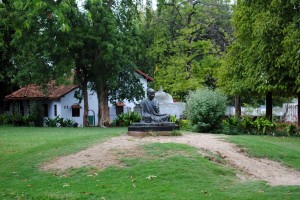
Gandhi Ashram - AhmedabadThe former capital of Gujarat, Ranked 3rd in Forbes 2010 list for the World’s fastest growing cities, Ahmedabad is the administrative centre of the state. Ahmedabad was founded by Sultan Ahmed Shah on 22nd February, 1411. Here you can see a mix of Hindu craftsmanship and Islamic architecture in the historical monuments. Victoria Gardens, Kankaria Lake, Gandhi Aashram, Bhadra Fort, Sidi Sayed Mosque, Akshardham Temple and Vaishnodevi Temple, Jama Masjid, Parimal Garden in Ellis Bridge area, Shri Swaminarayan Temple. Also a splendid sight of Sabarmati River and the adjoining bridges can be enjoyed from the coastal areas of the city of Ahmedabad.
Surat
Suvali beach SuratSituated on the banks of Tapti River, Surat is another commercial capital of the state, known for its textile and diamond business. The Chintamani Jain Temple, exquisite in its wooden carvings and paintings is a place of huge interest and the ancient Dutch gardens is a famous attraction. You can also find a lot of beaches in Surat city like Suvali, Hazira and Dandi beach, where one can enjoy the peace and isolation, away from the city hustle-bustle or you can enjoy the charm and beauty of a hill station, in Saputara on the Sahyadri hills.
Gandhinagar
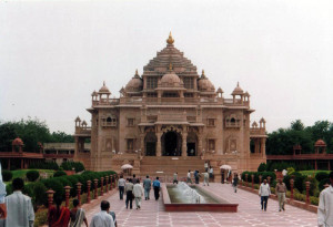
Akshardham Temple GandhinagarGandhinagar is the biggest city in Gujarat and it is the capital city as well. This city is well planned and named after Mahatma Gandhi and to reach here you need to travel only 23-25 km from Ahmedabad. The places of interest here are, Akshardham Temple, Adalaj Ni Vav, Sarita Udyan, Deer Park (Indroda Park), Dinosaurs Park and Punit van-a botanical garden.
Vadodara
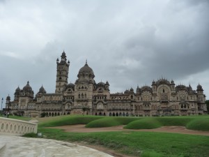
Lakshmi Vilas Palace BarodaFormerly known as Baroda,famous as the cultural capital of the state, the city of Vadodara is located on the banks of River Vishwamitri. The few best places that one can see in Baroda are the Maharaja Sayajirao University of Baroda and the Lakshmi Vilas Palace, famous for its Venetian mosaic-floor, Belgium stained glass windows and delicate decorative work on the walls. One section of the palace has been transformed into a museum , where various art works belonging to the Royal family are displayed along with the paintings of Raja Ravi Varma.
Patan
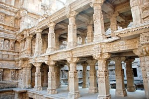
Rani ki Vav PatanThis district is located in North Gujarat and surrounded by Banaskantha district, Mehsana district, Surendranagar district and Kutch District. Established in 2000, the tourist sites which you can visit here are Rani ki Vav, Bhimdev, sahasralinga talav, Mahavir Swami Derasar and Siddhapur.
Jamnagar
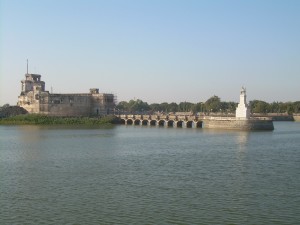
Lakhota Fort and-lakeEarlier known as Nawanagar and later substantially built by Maharaja Kumar Shri Ranjitsinhji in 1920, this city is also known as Oil City of India. Located at the south of Gulf of Kiutch there are various places to see like Darbargadh Palace, Lakhota Fort and lake, Willingdon Crescent, Pratap Vilas Palace, Kotha Bastion and Bhujio Kotho.
Pavagadh
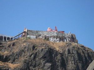
Mahakali Temple PavagadhFamous for the Mahakali Temple, Pavagadh attracts thousands of pilgrims every year. It is the gateway to Panchmahal and influenced by the tribal group of Bhils. The places to visit here are Machi Haveli, Raval Palace and Dudhia Tala.
Champaner
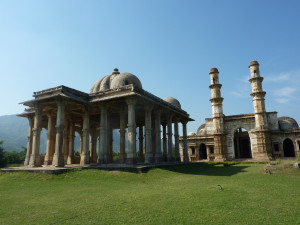
champaner pavagadhOnly 47 km from Vadodara this is a historical city of Gujarat and founded by Vanraj Chavda in the 8th century. The award winning film Laagan was shot in one of the village in Champaner. Here you can see three fortification bases Champaner, Pavagadh and Machi. The other places to see are Gates Halol gate, Delhi gate, Chhota Udepur, Jambu Ghoda and Laxmi Vilas Palace.
Saputara
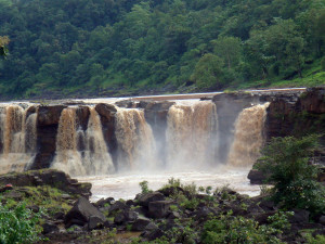
Gira falls-saputaraThe hill resort located in the Sahyadri Range, Saputara means The Abode of Serpents. As per the Hindu mythology, Lord Ram spent his 11 years of exile in the dense forests of Saputara. There is a deity of a serpent (snake) placed on the banks of the river Sarpaganga. Local tribal folks pay worship to this serpent god and celebrate festivals like Holi. Here you can visit Vansda National park, Purna Sanctuary, Gira falls and Mahal Bardipura forest.
Rajkot
Along the bank of Aji and Nyari River, Rajkot is the fourth largest city in Gujarat. Its a very important tourist destination as well. There are many important places that you can visit during your trip o the city of Rajkot. Watson Museum RajkotThis is because the city of Rajkot is deeply immersed in the local culture, and there are also many monuments and museums of public interest in Rajkot. There are several landmarks, which makes the city unique by itself, like Kaba Gandhi’s Gate, which is Mahatma Gandhi’s old ancestral home. This was built during 1880 and stands tall till date. This house has now been converted into a museum, Watson Museum, Lang Library, Gebanshah Pir Dargah, Hashanshah Pir Dargah and Turkibapu’s Dargah, Jagat Mandiris a very beautiful temple that is dedicated to Shri Ramakrishna Paramahamsa..
Dwarka
Dwarakadhish Temple - DwaraIt is believed that Dwarka is the dwelling place of Lord Krishna. Situated along the coast of Arabian Sea, the Dwarakadhish Temple is the main attraction of the Dwarka, Temple is rich in architectural value because of various sculptures and carved pillars. Here you can also see the convergence of River Gomti and Arabian Sea.
Bhavnagar
NeelamBag PalaceBhavsinhji Gohil founded this city in 1723 AD and today it is an important tourist destination. 228 km away from the capital city, Bhavnagar is the fifth largest city of Gujarat. The main tourist attraction here are Takhteshwar Temple, Neelambag Palace and Bhav Vilas Palace.
Junagadh
Uparkot FortAt the foothills of Girnar Hills the natural beauty of the city attracts tourist to enjoy the place. The places of interest here are Somnath, Girnar, Ashok Shilalekh, Sakkarbaug Zoo and Narsinh Mehta No Choro.
Uparkot
Five kilometers from Junagadh this location is visited by tourist for pilgrimage purpose. Here you can see Buddhist Stupas of 500-700 AD. The fort built by the Rajput on the Uparkot Hill is a beautiful creation.
Porbandar
Sri Hari Mandir-PorbandarPorbandar is mainly a coastal city that is well known among tourists, famous as the birth place of Mahatma Gandhi, gandhi house. The places to visit here are Sudama Mandir, Shri Hari Mandir, Ram Krishna Mission, Ram Dhoon Mandir, Rana Bapu’s Mahal and Chowpati.
Bhuj
Aina  Mahal ( mirror palace) BhujAt an elevation of 360 ft, Bhuj is the gateway to Kutch. Bhuj is known for its palaces built in the traditional Kutchi architectural styles. Among them, the Aina Mahal or the Palace of Mirrors is the most famous and one of its main highlights. Wildlife sanctuaries like Narayan Sarovar Sanctuary, Kutch Bustard Sanctuary are the major tourist attractions here.
Sarnath
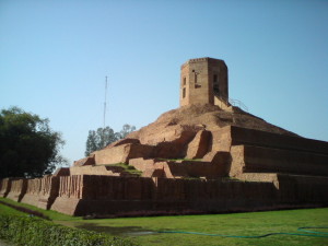
Chaukhandi Stupa sarnathNear to the port town in Junagadh, Sarnath is a famous as a pilgrimage center. The major tourist sites here are Chaukhandi Stupa, Ashoka Pillar and Sarnath Archeological Museum. The Chaukhandi Stupa is thought originally to have been built as a terraced temple during the Gupta period between the 4th to 6th Century to mark the site where Lord Buddha and his first disciples met traveling from Bodh Gaya to Sarnath. Later Govardhan, the son of a Raja, modified the stupa to its present shape by building the octagonal tower to commemorate the visit of Humayun, the powerful Mughal ruler.

Lakhota Fort & Kotha Bastion (JAMNAGAR)


In the centre of old Jamnagar, on an island in the middle of the lake, are two superb old structures: the Lakhota Fort and the Kotha Bastion.
Lakhota Fort is Jamnagar's Museum and its terraces exhibit a very well collection of sculpture that spans a time from the 9th to 18th Century. The Kotha Bastion is Jamnagar's arsenal. One of its most attractive places of interest is an old well, the water of which can be tense by blowing into a little hole in the floor.    


Bhujia Hill Fort


At a short distance from Bhuj town is the hill fort of Bhujia, the top surrounded by a parapet wall of no great strength, entered by one gate, and enclosing an irregular area with a few scattered buildings. The fort was built by Rao Godji as a sort of out-work defense for Bhuj. It was completed during Maharao Desalji's reign when the hill was crowned with its Snake Temple and was fortified as a further aid to the defense of the capital.


Snake Domain
At one corner is a small square tower dedicated to 'Bhujang Nag' (snake) said to have been the brother of 'Shesh Nag'- Lord of the under world ('Patal'), who came from Than of Kathiawar and freed Kachchh from the oppression of demons known as 'daityas' and 'rakshasas'. To commemorate this event, an annual fair is held on the fort-hill on the Nag Panchami day (Shravan Sun 5, August).


ENTRY 
Bhujia Hill fort is now under the jurisdiction of Indian Army. So it is strictly prohibited to enter in on any day except on the day of Nag Panchami fair.

શનિવાર, 28 એપ્રિલ, 2012

Aina Mahal


Location : Kachchh, Gujarat. Built By : Roa Lakhpatji. Built In: 18th Century. Main AttractionHall of Mirrors. mahal) Bhuj.


The last ruler of Kutch Maharao Madansinhji established the "Maharao of Kutch Aina Mahal Trust on 1st January, 1977. Aina Mahal means a mirror palace. It was created by the artists Ramsinh & Gaidhar Devshi in the period of Maharao Lakhpatji (1752-61). In 1757, Rao Lakhpatji visited the emperor Alamgir in Delhi. He was graced with the title of Mahi Maratib. He welcomed foreigners in his court. Fortune brought him a man named Ramsingh malam who specialized in Kutchi architecture, enamel work, jewellery, tile work and interior decoration. The great master piece of Ramsingh is the Hall of Mirrors in the Aina Mahal. The walls are white marble covered with mirror which are separated by gilded ornaments. The hall is lit by elaborate pendant candelabra with shades of Venetian glass. The hall of mirrors is on the second floor of the Aina Mahal but Ramsingh devised ingenious pumps and siphons to raise up water to fill the pleasure pool and to operate fountains which cast spray in an intricate variety of patterns charming the eye and cooling the air. The small state apartment, carpeted with exquisite Kutchi silk embroidery, its walls paneled high with the same priceless fabrics still contains Maharao Lakhpatji's bed. The hall is filled with a miscellaneous collection of objects; a Dutch Clock, English and French celestial globes, some antique pictures, mechanical toys, glass and china. On the walls of the corridor are a variety of pictures, some European and many Indian. The Aina Mahal alone cost eight million kories and was only one of the many enterprises which the Maharao and Ramsingh undertook together.
HALL OF MIRRORS
Aina Mahal, Aina Mahal historical, Aina Mahal travel, Aina Mahal tourism, Aina Mahal tourThe real attraction here, though, is the Hall of Mirrors, created by the master artisan, Ram Singh Malam, under the patronage of his poet-ruler, Maharao Shri Lakhpatji around the middle of the 18th century. A blend of Indian and European artistry (Ram Singh acquired, his skills in Europe), the walls of the great hall are of white marble covered by mirrors separated by gilded ornaments, lighting being provided by elaborate candelabra, with shades of Venetian glass. It has a platform above it surrounded by a series of fountains operated by an elaborated system of pumps below a Venetian chandelier. Another remarkable feature is the pleasure pool, in the middle of which rises a square platform where the Maharao composed his poems and gave encouragement to the classical arts of dancing girls, bards and musicians.


HISTORYCAL PLACES IN GUJARAT Adalaj Vav


Location : 18 Kms North of Ahmedabad, Gujarat. Meaning : Step Well. Built By : Ruda, Wife Of Vaghela Chief Virsinh. Built In : 15/16th Century AD.
Adalaj is a village 18 kms to the north of Ahmedabad . The 'Vav' (step-well) at Adalaj derives its name from the lady patron, Ruda, wife of the Vaghela chief, Virsinh; who built it in the 15th or 16th century AD. The 'Vav', laid out in the north-south direction, the step well with the well in the north and the entrance in the south, has a total extent of 75.3 meters. It is the only major monument of its kind, having three entrance stairs leading to the stepped hall. These three entrances assemble in the first storey, underground, in a huge square platform. The platform has an octagonal opening on the top.
The Structure
The platform rests on 16 pillars, eight on the corners, and two in front of each Adalaj Vav, Adalaj Vav historical, Adalaj Vav travel, Adalaj Vav tourism, Adalaj Vav Historical Placemain side. Four built-in shrines, with doors, windows and balconies, mark the four corners of the platform. The stepped corridor begins from this square platform. The corridor is entirely surrounded by a one-meter high ramparts wall with a rounded topping. It descends with four pavilion towers for five storeys. The walls of the 'Vav' are veritable showcases of sculptures and ornamentation. The sculptures range from a king sitting on a stool under a parasol, to erotic scenes; and from ladies churning buttermilk to dancing girls. The frames of the doors around the entrances of the twisting staircases to the octagonal shaft are surrounded by a 'parikrama', which is an enlarged version of the frames around the niches. Stringcourses running along the sidewalls embellish all parts of the structure, sometimes dividing the wall into horizontal sections. They also come into view on the walls of the 

સોમવાર, 2 એપ્રિલ, 2012

Mehrangarh Fort

Mehrangarh Fort

 Mehrangarh Fort, located in Jodhpur city in Rajasthan state, is one of the largest forts in India.

The fort is situated 400 feet (122 m) above the city and is enclosed by imposing thick walls. Inside its boundaries there are several palaces known for their intricate carvings and expansive courtyards. A winding road leads to and from the city below. The imprints of cannonball hits by attacking armies of Jaipur can still be seen on the second gate. To the left of the fort is the chhatri of Kirat Singh Soda, a soldier who fell on the spot defending the Mehrangarh fort.

There are seven gates, which include Jayapol (meaning 'victory'), built by Maharaja Man Singh to commemorate his victories over Jaipur and Bikaner armies. Fattehpol (also meaning 'victory') gate was built by Maharaja Ajit Singh to mark the defeat of the Mughals. The palm imprints upon these still attract much attention even today.

The museum in the Mehrangarh fort is one of the most well-stocked museums in Rajasthan. In one section of the fort museum there is a selection of old royal palanquins, including the elaborate domed gilt Mahadol palanquin, which was won in a battle from the Governor of Gujarat in 1730. The museum exhibits the heritage of the Rathores in arms, costumes, paintings and decorated period rooms.

શનિવાર, 17 માર્ચ, 2012

Kille Mahur


Mahur village, also called Mahor, is 40 kms north-west of Kinwat town in Handed district in the Marathawada division of Maharashtra.  Earlier Mahur was a big city and a Suba of southern Berar.  Situated on an eastern branch of Sahyadri Mountains, the hill fort here is very old and exists at least from the time of the Yadavas.  It was subsequently occupied by many powers - the Gonds, the Bahamanis, the Adilshani and the Nizamshahi rulers and finally the Mughals and their vassals.  The fort on its three sides is girded by the Painganga River.
The fort built on top of two adjoining hills, was protected by walls, ramparts and bastions.  It had two main gateways - one on the southern side and the other on the northern side.  The northern gate is still in a reasonably good condition, and so is its southern rampart nearly five metres wide.  The fort had a palace, a mosque, a granary, an armoury, etc., now all in ruins.  At the centre of the fort, there is a big tank call Ijalatalav.
Being situated on the main route from the north to the Deccan, Mahur has a long history.  There is evidence to show that Mahur, ancient Matapur, was an important place at the time of the Satavahanas and the Rashtrakutas.  The Renuka temple on an adjoining hill was built by the Yadavas.  After remaining with the Gond rulers for sometime, Mahur passed on to the Bahamanis in the 15th century and was made a Suba.  In the 16th century, Mahur, being strategically placed at their centre, faced a lot of fire from the infighting between the Nizamshahi, Adilshahi and Imadshahi rulers.  Then in the early 17th century, Mahur became a part of the Mughal Empire and came to be ruled by their Subedars.  When Shahjahan rebelled against his father Jahangir, he took refuge in the Mahur fort along with his wife and children, including 6 years old Aurangzeb.
About 2kms from Mahur bus-stand, there are two Elephant type (situated on an island near Mumbai) rock-cut caves of the Rashtrakuta period.
Pictures: Remains of rampart and a bastion on the South-Western side of the Mahur fort, and its northern gate ‘Hathi Darwaja’ (inset).  Behind the bastion, on another hill, is the Renuka temple.

Ballalpur, Chandrapur and Manikgarh Forts


Situated in Chandrapur (old Chanda) district of Maharashtra, all the three forts are of tribal origin.  Ballalpur, now known for its coal mines and paper mills, is 16kms south-eat of Chandrapur, the district headquarters, Ballalpur was the capital of the Good king Khandakya Ballalshah during 1437-62 AD.  The land fort that he built here on the eastern bank of the Wardha River is square in shape with walls and bastions.  There are still two intact gates set at right angle to each other.  There is also a small postern gate on the river side.  The fort walls are still intact, but all the old buildings are in total ruins.
The credit for establishing Chandrapur also goes to Khandakya Ballalshah.  When the capital was shifted from Ballalpur to Chandrapur, the Ballal kings built here an extensive land fort with high walls and bastions.  The fort had at its four cardinal points four impressive gates.  The original buildings have vanished, but the gates and a portion of the wall still exists.  Chandrapur was annexed by Raghuji Bhosale of Nagpur in the middle of the 18th century.  Finally the fort was captured by the Britishers in 1818 AD.  Now an industrial town, Chandrapur is also famous for it s old Mahakali temple.

Manikgarh, made famous by a newly established cement factory near by, is about 35kms south-west of Chandrapur.  Built by tribal Naga kings in the 9th century, the Manigarh hill fort stands at the height of 507 metres above sea-level.  It was strongly fortified with walls and bastions.  There were several tanks and buildings inside the fort.  Today, the fort is in complete ruins and has become a sanctuary for wild animals.  A pukka road through a dense forest leads very close to the gateway of the fort.  Nearby is an old temple of Vishnu.
Pictures: The Wardha river-side rampart and bastion of the Ballalpur for (above, left).  The main gate of the Ballalpur for from inside (above, right).  The ruined gate-way of the Manikgarh hill fort (below, left).  A portion of the rampart of the Chandrapur fort (below, right).

Ahmadnagar Fort


One of the most well planned and strongly built, the Ahamadnagar land fort is situated in the centre of the cantonment in the eastern part of the city.  Oval in shape, the fort is about 1.70km in circumference and is strengthened by 24 bastions.  It is surrounded by a moat, now dry, about 30 metres wide and 4 to 6 metres deep, and beyond it there is a wooded glacis.  The massive curtain wall, built of cut stone masonry, rises above 25 metres from the bottom of the ditch.  The two entrances to the fort could be reached only after crossing the moat over the suspension drawn bridges.  Inside the fort there are some old and new buildings, fairly in good condition.  Presently the fort is under Indian military command.
The Ahamadnagar fort was built by Husain Nizam Shah in 1559 AD.  The fort was besieged by the vast Mughal army in 1596 AD, but the garrison led by Chandbibi valiantly defied the attack for four months and the Mughals had to beat a retreat.   In the next attack in 1600 AD, the fort was captured by Akbar.  It remained with the Mughals till 1759 Ad, when it was sold to Sadashiv Bhau, the cousin of the third Peshwa.  In 1797 AD, the fort was assigned to Daulatrao Shinde, from whom it was captured by General Welleslay in August, 1803.  Finally under the Treaty of Pune (June, 1817 AD) the fort was handed over to the British by Bajirav Peshwa II.

The Ahamadnagar fort was often used as royal prison, both by the Marathas and the British, Nana Phadnis, who was instrumental in imprisoning many Martha noblemen in this fort was himself locked up in the fort by Daulatrao Shinde.  During the Quit India Movement of 1942, the entire Congress Working Committee was detained here.  Pt. Jawaharlal Nehru wrote his famous work Discovery of India while in confinement at the Ahamadnagar fort.
Pictures: The main entrance to the Ahamadnagar for with its two gateways placed at right angles (above).  The outer gate (only is upper half) is on the left side and the inner gate is the front one.  A water-outlet on the left wall of the inner gate with a sculpture of a tiger trampling on an elephant (insert, above).  A portion of the massive wall of the fort with a bastion, the most on the left is grown with babul and other trees (below).

Pauni and Nagardhan Fort


Pauni, in Bhandara district, is 82kms south-east of Nagpur.  The present town, about three kms south-west of the Wainganga River, is engirdled by medieval fortifications embellished by imposing gateways, of which those situate to the west are almost intact.  The majestic fortifications, which at some places are extant to a height of about 20 metres, were encircled by a moat of about 20 metres in width.  The ancient moat has now turned into a small seasonal lake and is called Balasamudra.  The fort was constructed by the Gond ruler Bakht Buland in the early 18th century and was taken over by Raghuji Bhosale I around 1710 AD.
Pauni, an ancient place, has yielded the relics of one of the greatest Stupas of India and definite evidence of a flourishing Buddhist establishment.  The Pauni rampart has yielded the copper plate grant of Pravarasena II of the Vakatakas who ruled over this region.  So it is possible that the clay of the rampart goes back to a period much earlier than the medieval.
Nagardhan, ancient Nandivardhan, the first capital of the Vakatakas, is 34 kms northeast of Nagpur and about 5kms south of Ramtek, famous for its fortified hill temple.

The present land for at Nagardhan, probably built by Raghuji Bhosale I around 1740 AD, must have served the purpose of guarding the eastern approaches to Napur.  Square in shape, it has an outer rampart with bastions and had an inner wall surrounding the buildings.  The main gate, still in good condition, is on the north-west side.  In the fort there is a temple below the ground level and the idol is placed on a ledge of a well like structure.
Not far away from the present for there is a place where big sized bricks of ancient periods are often discovered.  This is said to be a site of the capital-cum fort of the Vakatakas.
Pictures: A distant view of the Pauni fort with the ancient moat, now turned into a seasonal lake (above).  Wide rampart and high parapet of the fort (inset).  Front wall with a bastion and the main gate of the Nagardhan fort (below).  The main gate (inset).

Narnala, Akola and Achalpur Forts


Narnala fort, standing upon an isolated hill of the Satpuda range, is 18kms north of Akot, a taluka town in Akola district.  It is 973 metres above sea-level and consists of three distinct hill forts: Jafarabad in the north-east, Narnala, the principal fort, in the centre,and Teliagarh in the south-west.  It was protected by a curtain wall about 9 metres high with 67 bastions and six large gates.  The Shahnur or “Mahakali” gate, built by Fateh-ullah Imad-ul-Mulk in 1487 AD, is not notable example of Sultanate architecture.  The white sandstone gateway has Arabic inscriptions on it and is flanked upon on either side by galleries and rooms, probably for guards, but the most striking feature of the gateway is the overhanging balconied windows, two on either side.  Within the fort are a number of tanks and cisterns, large cannon, known as nau-gazi top, and old palace, an armoury, a baradari, a mosque and other buildings, all in ruins.
According to tradition a very old fort, Narnala was repaired by Ahmad Shah Bahamani around 1425 AD, and in 1487 AD it came under the control of Fateh-ullah Imad-ul-Mulk, the founder of Imadshahi at Ellichpur, now called Achalpur.  During Akbar’s rule.  Narnala was a Suba. Narnala was captured by Parsoji Bhosale I in 1701 AD and remained with the Marathas till it was taken over by the British in 1803 AD.
The history of Achalpur, formerly known as Ellichpur, could well be said to be history of Vidarbha (Berar) itself.  Nawab Sultan Khan, the first of his dynasty, built the fort at Sultanapura in Achalpur on the south the bank of the Sarpan River in about 1754 AD.  Much of the part of the fort is now in completely dilapidated condition.  The city was fortified by Sultan Khan’s son Ismail Khan by a huge and solid rampart wall of masonry with four gates.  Most of the fortifications and the gates are still intact.
Pictures: The Shahnur or Mahakali gate of the Narnala fort (above, left).  The overhanging balconied windows on the left flank of the Mahakali gate (above, right).  The remaining high tower of the Akola fort (below, left).  A gate flanked by two bastions of the Achalpur fort (below, right)

Tryambak and Chakan Forts


Tryambak or Brahmagath hill fort, overlooking the holy temple of Tryambakeshwar, is 32kms south-west of Nasik town.  The fort was built on a high hill with steep scarps to its each face.  Besides, it was fortified by walls and bastions.  There are only two gateways.  The main southern access is through the steep steps (about 300 in numbers) cut out of a near vertical scarp and passing through rock cut gates.  The northern access is through only a single gate approached by a narrow passage with steps cut from the rock.  The fort is now in ruins.  From the top of Tryambak, one can have grand view of the Harihar, Anjaneri and a few other hill forts.
Being in the category of Devagiri, Tryambak fort seems to be of Rashtrakuta-Yadava origin.  After the Yadavas (1271AD) it was occupied by the Nizamshahi sultans, the Mughals and the Marathas.  Tryambak and its cluster of forts provided cover to upper Konkan and so was of strategic importance.  In 1818 AD, when Tryambak was taken over by the British with a tough fight, the surrounding forts surrendered without any resistance.  The river Godavari originates from the Tryambak hill.
Chakan village and its landfort is 29kms north of Pune. Nearly square, the fort was protected by a strong wall with bastions and corner towers surrounded by a moat.  There was also an inner wall.  The fort is now in ruins.
The Chakan for is quite old and was occupied by several powers.  An Abyssinian chief is said to have made the first fortification in 1295 AD.  In 1595 AD.  It was given in jagirto Shivaji’s grandfather, Maloji Bhosale.  An important event occurred here when the fort was captured by Shaista Khan in 1660 AD. Being on the shortest route from Ahmadnagar to Konkan, Chakan was a place of great strategic importance.  The fort was captured from the Marathas by the British in 1818 AD.

Suvarnadurg Fort


The island fort of Suvarnadurg stands close to Harne in Ratnagiri Distric, a natural harbour famous for fishing and its marketing.  A very strong fort, its walls are cut out of solid rock and the ramparts are raised by using huge square blocks.  No mortar was used in the walls.  The fort has many bastions and a postern gated on the western side.  The hidden main gate opens towards the east.  It has on its threshold a carved figure of a tortoise and on the side wall, that of Maruti (Hanuman).  Inside the fort there were several buildings, water tanks and a place for ordinance.  All the buildings are now in ruins.
The fort was probably built by the Bijapur kings in the 17th century.  Captured and strengthened by Shivaji, it became a stronghold of Maratha navy and remained with the Peshwas till 1818 AD.  It was one of the main naval bases of the Angres.
Gova, Kanakadurg and Fatehgarh forts on the mainland are separated from Suvarnadurg by a narrow channel.  The small Gova fort was stronger than the other two.  It has two gates, one towards the land and another towards the sea.  On the wall of the sea-gate there are carved figures of a tiger, eagle and elephants.  The old buildings inside the fort are in ruins.
Kanakadurg has the sea on three sides.  Nothing remains of the fort, except two broken bastions.  There is a light at its higher point.  Fatehgarh is in complete ruin.  Most probably, these three small forts were built by Kanhoji Angre (1667-1729AD) to protect Suvarnadurg from the land route.
Pictures: A distant view of Suvarnadurg from the Gova fort (above), and a wall with a bastions of the Gova fort (below).

Kondana Sinhagarh Fort


Sinhagarh fort, whose earlier name was Kondana or Kondhana, stands 20kms, south-west of Pune.  Perched on an isolated cliff of the Bhuleswar range of the Sahyadri Mountains, its height above sea-level is 1380 metres.  Given natural protection by its very steep slopes, the walls and bastions were constructed at only key places; it has two gates – the Kalyan Darwaza in the south-east and the Pun Darwaza in the north-east
Sinhagarh has a long history.  It was captured from theKoli tribal chieftain, Nag Naik, by Muhammad bin Tughlaq in 1328 AD.  Three centuries later, Shivaji wrested it away by bribing the commander, by the Treaty of Purandar (1665 AD) had to cede the fort to the Mughals.  Sinhagarh was the scene of one of the most daring exploits in Maratha history when, in 1670 AD, it was recaptured by Shivjaji’s forces under Tanaji Malusare, who laid down his life in the battle.  On his death, a saddened Shivaji said, “The fort is won, but the lion is gone!” Whereupon the fort got is new name:  Sinha (lion) gadha (fort).  Finally the British seized the fort from the Peshwas in 1818 AD, destroying its almost all ancient monuments.  Only the traditional gates and broken walls remain now.

The upper surface of the fort is undulating and retains few buildings, Ruins of temples, tombs and towers are scattered about.  Near the gorge is a monument (Samadhi) commemorating the bravery of Tanaji.  There is also a tiny tomb of Rajaram, Shivaji’s son, who died here in 1700 AD. Also there are few bungalows, including that of Lokamanya Tilak.

In the Maratha period Sinhagarh played the crucial role of defending Pune.  The National Defence Academy (Kharakwalsa) trains its army cadet’s right under the shadows of Sinhagrah.
Pictures: Sinhagarh fort with its Kalyan gate flanked by two ruined bastions, and the Pune Darwaza (inset).